The Swedish Environmental Protection Agency (Naturvårdsverket) has as one of its major tasks spreading data about our environment. In 2017, they published a policy on re-using their data, which specifies the two copyright licenses they use: CC-BY for images, videos, sound recordings and reports – and CC0 for other kinds of data. The CC0 marking makes the data free to reuse, publish, enrich and disseminate for everyone, without need for attribution. The policy applies not only to data that Naturvårdsverket produces, but also to data given to them by other actors, be it other public agencies or organizations in the private or public sector.

This was great news for Wikidata editors, as only data that’s CC0 or public domain is compatible with the platform.
What does it mean in practice? Let’s take a look at what sort of data is available!
In Naturvårdsverket’s geodata portal, we can see several categories, such as biota (the plant and animal life of different regions), health, environment and inland waters. For us at Wikimedia Sverige, the most interesting geodata was that of protected natural areas, as it would make it possible for us to run our very first edition of Wiki Loves Earth. While we have been organizing Wiki Loves Monuments since 2011. WLE was not possible due to the lack of a freely available, comprehensive list of protected natural areas in Sweden. Did you know that Sweden has over 5,000 nature reserves? A good number of them – far from all – had Wikipedia articles and Wikidata items, but without an official data source, it was hard to know which ones were missing. Most of our nature reserves are under the administration of local county administrative boards, so in order for the community to assemble a comprehensive list on their own, they would have to check the websites of each and every county administrative board. Furthermore, a small number of nature reserves are under municipal administration.
Fortunately, complete datasets of Swedish nature reserves, national parks and natural monuments are available from Naturvårdsverket under a CC0 license!
Fun with maps
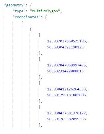
Besides being a complete source of which nature reserves exist, the data from Naturvårdsverket contains a lot of interesting information. How big the reserve is, how much of it is water, forest or land, as well as when it was founded. And then, of course – as already mentioned – geodata, that is, maps! Since a couple of years ago, it has been possible to store map data in the GeoJSON format on Wikimedia Commons. It is an open standard format for representing simple geographical features, such as points (like addresses and locations), lines (like roads and borders) and polygons (like countries and tracts of land). In the Map data category on Commons, you can see examples from a number of countries, all from provinces of Argentina to metro lines in Bilbao.
Now if you look at the source code at any of the files in the category Map data of nature reserves of Sweden, it might look overwhelming if you’ve never worked with GeoJSON before. It’s not an image file, but a set of data points. What’s great about it is that it can be accessed, displayed and processed externally, not only on the Wikimedia platforms.
Lowering thresholds for participation
One of the biggest challenges of organizing a Wiki Loves competition is attracting participants. While many of the photographers are seasoned Wikimedians, every year we look forward to welcoming newcomers. And it’s easier said than done. It can be a challenge to navigate the culture and technicalities of the Wikimedia platforms if all you want is to upload a photo. To contribute to most Wiki Loves competitions, you have to locate a relevant list of participating objects to use as your point of entry.
That’s why we’re continuously investigating ways of simplifying the process.
Enter The WLE Map.
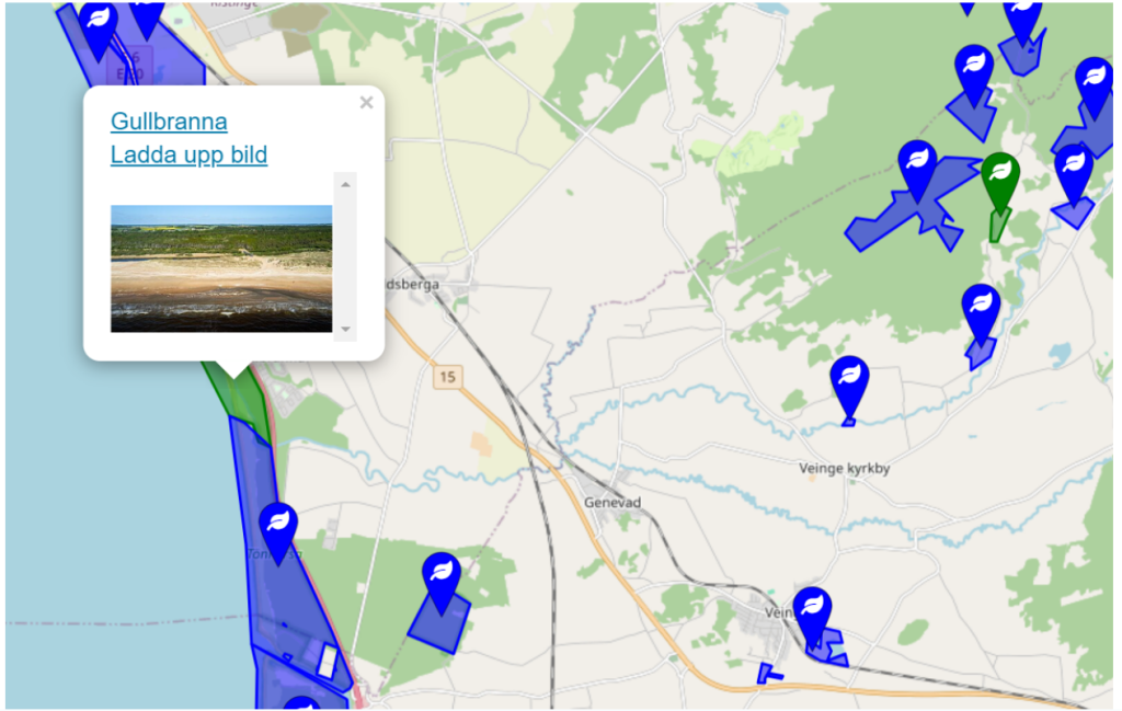
It was created by our colleague Karl Wettin using the data from Wikidata and Wikimedia Commons, originally published under an open license by Naturvårdsverket. It provides a simple overview of Sweden’s protected natural areas – national parks, nature reserves and natural monuments, such as old trees – and makes it possible to reach the WLE upload campaign with a single click. As the map is color-coded, with blue areas and points lacking a photo on Wikidata, it’s easy to find areas that are in need of photographing.
The map has been a highlight of every WLE competition so far. Its creation was made possible by the freely licensed, official data from Naturvårdsverket, and it exemplifies how open geodata can be used for the benefit of our community.
Can you help us translate this article?
In order for this article to reach as many people as possible we would like your help. Can you translate this article to get the message out?
Start translation