For thousands of years, humans have used maps to define, understand and navigate the world in which we live. From cave drawings to star maps to geospatial navigation, maps have been an ever-improving tool for people everywhere. In today’s increasingly connected world, maps play a critical role in areas like humanitarian response to disasters, understanding the spread of disease, and much more. Like any information resource, however, maps vary in terms of accuracy and accessibility.
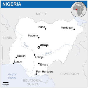
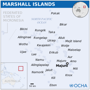
The United Nations Office for the Coordination of Humanitarian Affairs (OCHA) believes that accurate, reliable, and easy-to-understand maps should be available to everyone. That is why they’ve partnered with Wikimedia New York City and ReliefWeb to release a collection of more than 200 freely licensed “country-location” maps that are available on Wikimedia Commons and on the ReliefWeb site. In addition, many maps are also featured on Wikipedia country pages.
We are excited to announce this collaboration on GIS Day, which provides an international forum for users of geographic information systems (GIS) technology to demonstrate real-world applications that are making a difference in our society. The project is intended to give the humanitarian community and the public access to free, accurate, and attractive maps, wherever they may be.
These maps were originally created as part of OCHA’s focus on information management and geographical visualization, in order to support the coordination of humanitarian partners during the response to an emergency or natural disaster anywhere in the world. OCHA location maps were designed to be embedded into a report or a website, offering essential information, such as main cities and neighbouring countries, while using a sleek and effective design.
Gwi-Yeop Son, Director of OCHA’s Corporate Programmes Division, said that OCHA is pleased to share the maps openly and publicly. “OCHA can now offer Wikipedia’s nearly half a billion readers the ability to study and reuse those maps as they see fit,” she said. This is thanks to the community of volunteers who dedicate time and energy to write, edit, and check entries to ensure information is current and relevant.
Access to accurate, free and reliable maps has implications for a variety of efforts, including combating climate change. The Green Growth Knowledge Platform, a partnership of more than 30 leading organizations that generate, manage and share green-growth knowledge, uses OCHA’s maps to gain geographical context important to understanding a country’s efforts to transition to a green economy. According to Amanda McKee, the Communications and Outreach Officer for the Green Growth Knowledge Platform, “the accurate and up-to-date location maps from OCHA enable us to provide this context on the 193 country dashboards offered on the Green Growth Knowledge Platform.”
Since OCHA first created the location maps, it has made a series of improvements including design updates and new territories. The accessibility of these maps allows any user to publish location maps as is, or edit each element of the content. All the maps are freely licensed under the Creative Commons Attribution 3.0 unported licence.
Richard Knipel
President, Wikimedia New York City

Can you help us translate this article?
In order for this article to reach as many people as possible we would like your help. Can you translate this article to get the message out?
Start translation

